Shuksan Geomatics
GIS  Drone-Based Photogrammetry (FAA 107-Licensed)
 Geoprocessing
Scripting Cartography
Geoprocessing
Scripting Cartography
Geoprocessing
Scripting CartographyDrone Mapping Examples
Drone-Generated Orthomosaic Aerial Imagery: This example highlights a close-up of a three-centimeter orthomosaic image, wherein one image pixel equals 3 centimeters on the ground. This orthomosaic was generated from several hundred individual drone images captured at 200 feet above ground level. The collection area for this project was about 60 acres and required 30 minutes of drone time, plus several hours of computer processing time. Higher-resolution imagery is possible with lower flight elevations and slower drone speeds.
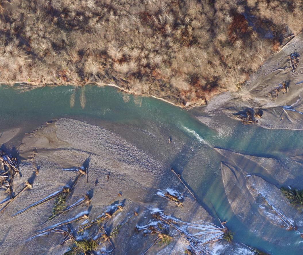
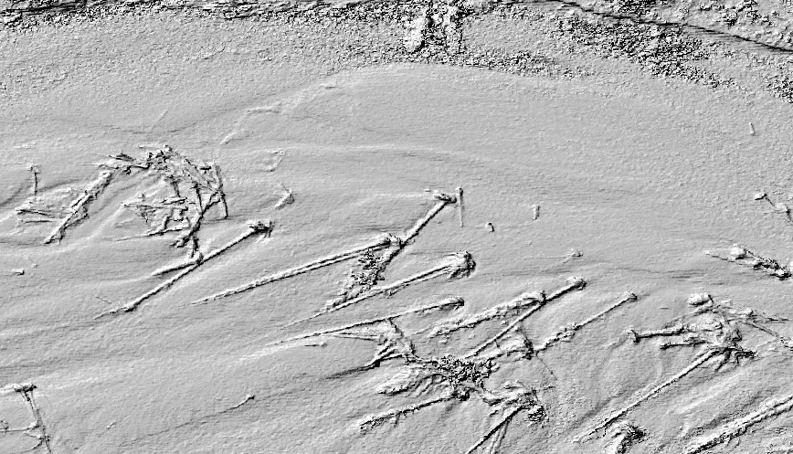
Structure-from-Motion Reconstruction from Multiple Drone Images: This example highlights a three-centimeter surface model generated from the same imagery as the orthomosaic above. This type of reconstruction is best suited for sparsely vegetated areas like river channels, borrow pits, clearcuts, or construction sites. For this flight, engineers used the resulting surface model to model the potential effects of a proposed restoration project on flow conditions in the North Fork Nooksack River, Whatcom County, Washington.
Cartography
Download and view maps and your location without cellual coverage with free and low-cost geospatial PDF maps for Avenza (free app for iOS and Android) available here.
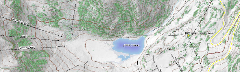
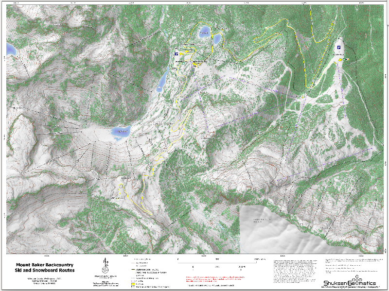
Climbing maps are available for: Mt. Baker, Mt. Rainier, Shuksan, Glacier Peak, Mt Adams, Whitehorse, Whitechuck, Mt Sefrit, Sperry Peak, Vespers Peak, Big Four Mountain, Mount Stuart, Twin Sisters. Other maps are available for Grandstaircase Escalante National Monument, Bears Ears National Monument, Sedona MTB, Spider Gap Loop, and Black Rock City.Mount Baker Backcountry Ski Routes This map features multi-directional hillshading and high-accuracy LiDAR data showing actual tree locations. Roads, trails, chairlifts, and ski-hill facilities were manually digitized from 2013 NAIP data. Decent routes were generated from personal knowledge or sourced from experienced backcountry skier/boarders. A Python script was generated to create sine-wave patterns along the descent lines for a nice cartographic effect.
Download to Avenza Maps (free download for iOS and Android)
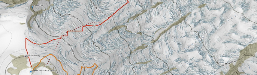
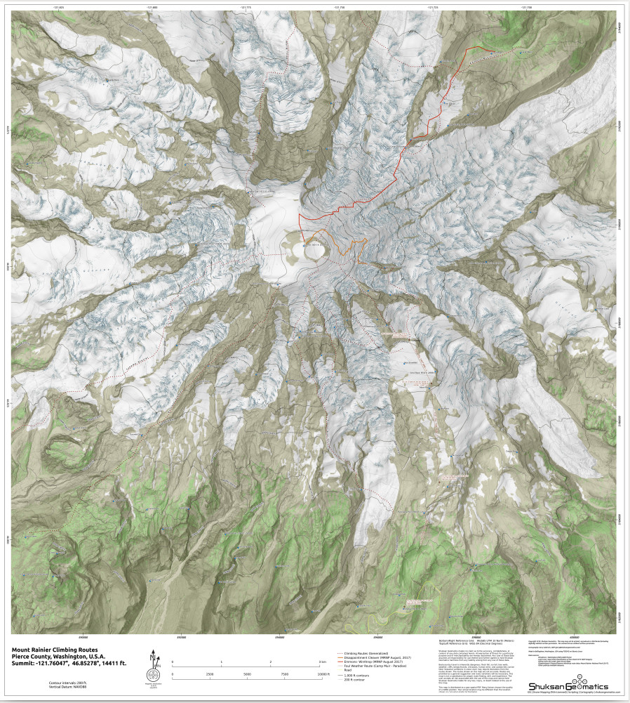
Mount Rainier Climbing Routes This map was created using mosaicked LiDAR elevation datasets, multi-directional-hillshading, and heads-up digitizing. The crevasses shown on this map are the actual crevasses exposed during recent LiDAR flights. Climbing routes (generalized) were generated from personal knowledge or gleaned from climbing reports. This map includes the most recently publish MRNP climbing ranger routes to highlight the difference between an actual route and a generalized route.
Download to Avenza Maps (free download for iOS and Android)
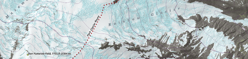
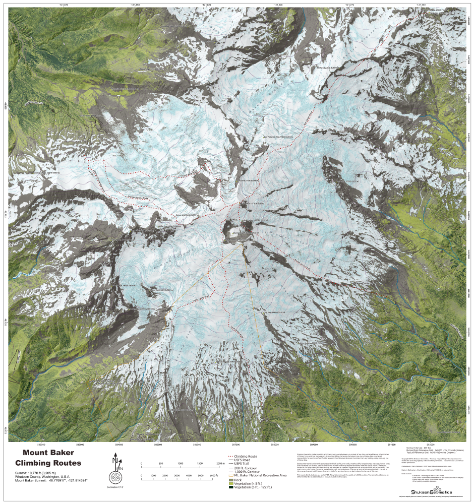
Mount Baker Climbing Routes This map was generated using LiDAR data. The crevasses shown on this map were exposed at the time of data collection. LiDAR return intensity and first and last return LiDAR points were used to derive tree heights as shown on this map and to differentiate among tall conifers, scrub/alpine meadow, and snow. Climbing routes were generated from personal knowledge or gleaned from climbing reports.
Download to Avenza Maps (free download for iOS and Android)